President William Ruto has directed government agencies to intensify rescue and relief operations as heavy rains continue to cause flooding in several parts of the country.
In a statement on Sunday, March 15, he expressed concern about the impact of the ongoing rains, noting that lives and livelihoods remain at risk.
"The ongoing heavy rains affecting several parts of our country continue to put lives and livelihoods at risk. My thoughts are with the families and communities that have already been affected during this difficult period," he said.
Ruto said the government has already activated a coordinated response involving multiple agencies to manage the situation and support affected residents.
"I want to assure all Kenyans that the Government remains fully mobilised to respond. Last week, I directed the activation of a multi-agency response bringing together emergency services, security agencies, humanitarian teams and technical departments to coordinate efforts and manage the situation effectively in Nairobi and across the country," he added.
Read More
According to Ruto, rescue and evacuation operations are currently underway in affected areas, while authorities are also working to address blocked drainage systems and damaged access routes.
“Relevant agencies are also actively assisting with rescue and evacuation operations, as well as clearing blocked drainage systems and restoring access routes in affected areas," he continued.
Ruto further noted that the national government is collaborating with county administrations to ensure residents receive immediate support, including food and medical supplies.
"The National Government is working closely with county governments to ensure the safety and protection of all citizens. Emergency food supplies and medical assistance are already being delivered to all people affected by the floods," he further said.

At the same time, Ruto urged Kenyans to pay attention to official advisories issued by authorities as the rains continue.
"We continue to closely monitor the situation, and I urge all Kenyans to strictly follow the guidance issued by relevant authorities, including the Kenya Meteorological Department and the police. These advisories are issued for your safety, and adherence to them will help us protect lives during this challenging period," he concluded.
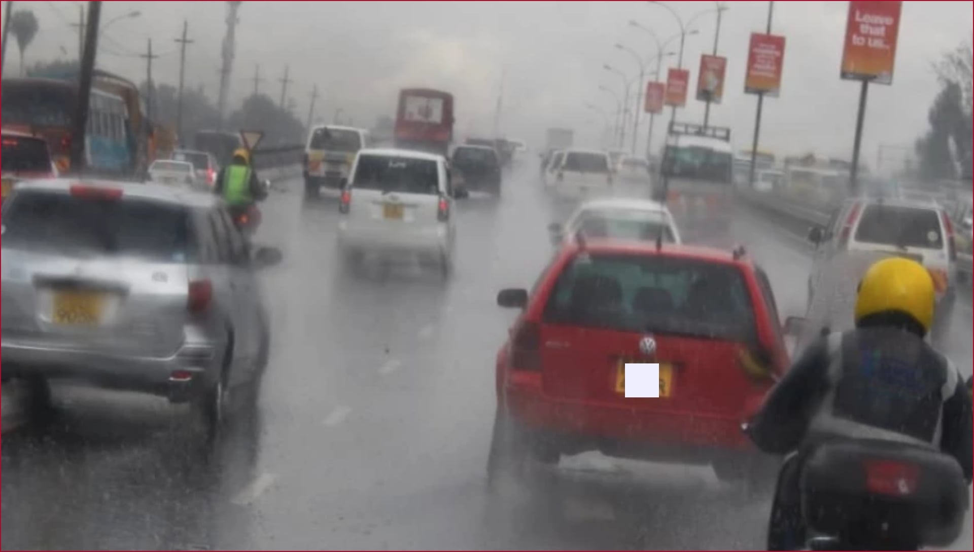
Meanwhile, the Ministry of Interior has identified flood-prone areas within Nairobi, counselling residents to be vigilant to avert crisis.
Heavy downpour in the city and its environs in the recent days has occasioned flooding disaster, causing deaths and loss of property.
In its advisory, the ministry identified several localities within Nairobi which may not avoid flooding due to their topographical realities.
It is based on a survey carried out under the Nairobi Rivers Regeneration Programme, which pinpointed 37 localities situated along major river corridors and areas at risk of flooding.
In Nairobi East, the mapped neighbourhoods include Kiambiu, Dandora, Kariobangi, Kayole, Komarock, Njiru, Ruai, Mwiki, Donholm, Savannah, Tassia, and Fedha, many of which are positioned downstream along stretches of the Nairobi River and its tributaries.
In Nairobi West, flood‑susceptible zones comprise Madaraka, Nairobi West, Lang’ata, Kawangware, Kangemi, Lavington, Westlands, Parklands, Kitisuru, Spring Valley, Kileleshwa, and Chiromo, all located along upstream and midstream portions of the river system.
In the Nairobi North corridor, settlements such as Mathare, Korogocho, and Lucky Summer have been flagged along the Mathare River, where dense housing clusters closely border the riverbanks.
Within Nairobi Central, notable sites along the river corridor include the Central Business District (CBD), Globe, Gikomba, Eastleigh, and the Industrial Area, through which sections of the Nairobi River flow.
In Nairobi South, the mapping exercise highlights Kilimani, Kibera, South C, South B, Mukuru Kwa Reuben, and Kwa Njenga, many of which are situated along the Ngong River corridor.
The ministry noted that coordinated disaster response teams would continue to deliver relief and manage emergencies, advising the residents living near riparian zones and in low‑lying areas to stay alert and prioritise their safety during periods of intense rainfall.