The World Meteorological Organization (WMO) has flagged a potential return of El Niño conditions in mid-2026.
In a statement on Friday, April 24, WMO said the observation follows new climate projections that point to significant warming in the Equatorial Pacific Ocean.
According to WMO, the latest update suggests the phenomenon could begin developing between May and July.
According to the agency’s monthly Global Seasonal Climate Update, rising sea-surface temperatures are already being recorded, with forecasts also pointing to widespread above-average land temperatures globally over the next three months.
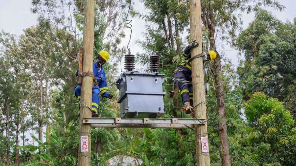
The changes are expected to influence rainfall patterns differently across regions, with some areas experiencing heavier precipitation while others face drier conditions.
Read More
"After a period of neutral conditions at the start of the year, climate models are now strongly aligned, and there is high confidence in the onset of El Niño, followed by further intensification in the months that follow," said Wilfran Moufouma Okia, Chief of Climate Prediction at WMO.
Okia, however, cautioned that forecasting at this time of year still carries some uncertainty due to seasonal limitations in climate prediction models.
"Models indicate that this may be a strong event - but the so-called spring predictability barrier is a challenge for the certainty of forecasts at this time of year. Forecast confidence generally improves after April," he added.

El Niño occurs when ocean temperatures in the central and eastern Equatorial Pacific become warmer than usual.
Its effects are felt globally; it often contributes to rising global temperatures and can intensify climate extremes.
The record-breaking heat observed in 2024, for instance, was driven by a combination of a strong 2023–2024 El Niño and ongoing human-induced climate change linked to greenhouse gas emissions.
While current research shows no direct evidence that climate change increases how often or how strongly El Niño events occur, scientists note that a warmer atmosphere and ocean can amplify their impacts, increasing the likelihood of severe heatwaves and intense rainfall.
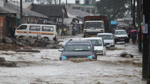
This comes days after the Kenya Meteorological Department warned of widespread rainfall and possible isolated storms across several parts of the country at the start of the new week.
According to the forecast maps covering Sunday, April 19, to Thursday, April 23, rainfall is expected in multiple counties, with some areas likely to receive heavier amounts than others.
According to Kenya Met, rainfall is expected over several parts of the country, particularly in the Northeastern region, Coastal region, Highlands East of the Rift Valley, including Nairobi County, Highlands West of the Rift Valley, the Lake Victoria Basin, the Rift Valley, and some parts of the Southeastern Lowlands.
The forecast maps show rain activity spreading across eastern and coastal Kenya, sections of central Kenya, western regions around Lake Victoria, and parts of the Rift Valley.
Some northeastern areas are also expected to receive showers during the forecast period.
The department further warned that isolated storms are likely in areas that will receive rainfall.
Nairobi County is among the areas expected to receive rainfall, alongside neighboring counties in the central highlands.
Western Kenya and Lake Victoria Basin counties are also likely to continue experiencing wet conditions.
Coastal counties, including Mombasa, Kilifi, Kwale, Lamu, and Tana River, are also expected to receive rainfall, with some locations likely to record intense showers and thunderstorms.